|
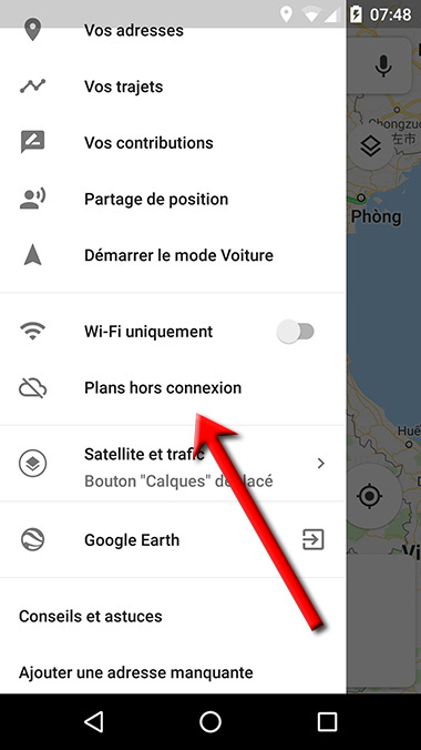 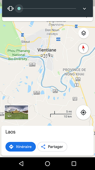 
Télécharger les Plans hors connexion dans Google Maps
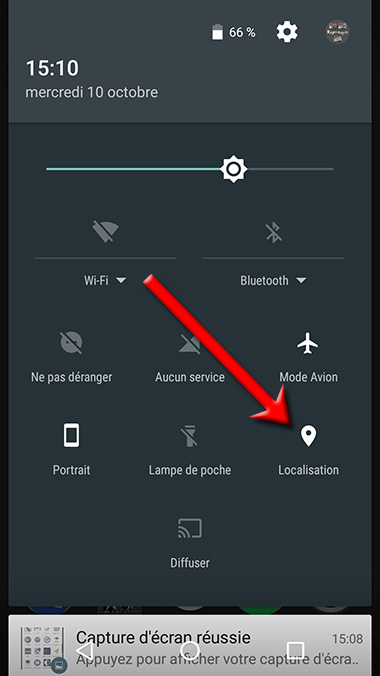
Mode Avion
Activer la Localisation (le GPS)
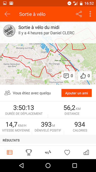
L'application ne propose que l'enregistrement
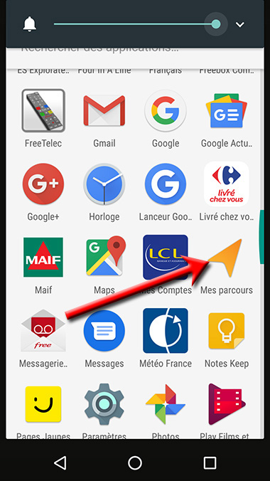  
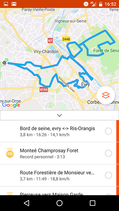
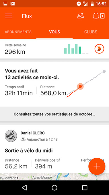
Utiliser l'application "Mes parcours"
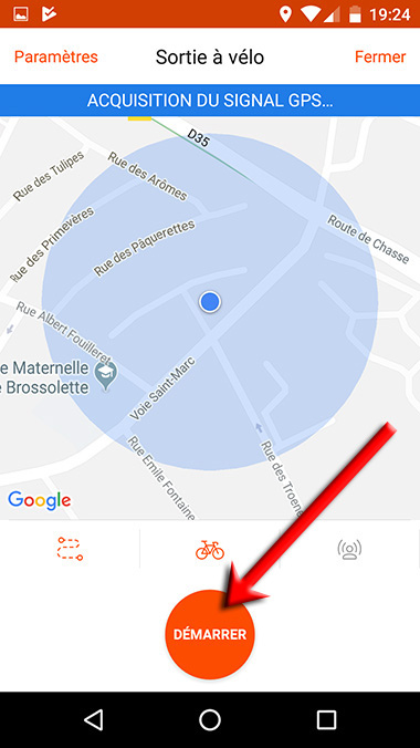
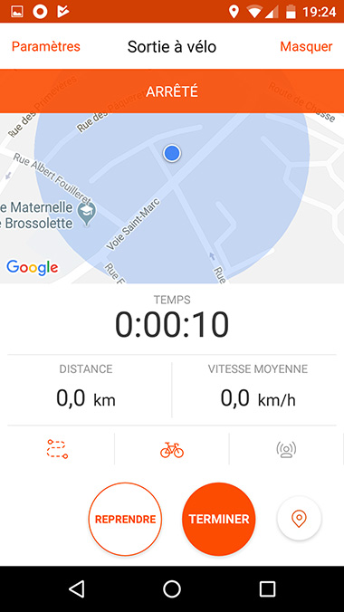
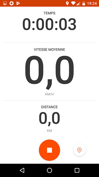
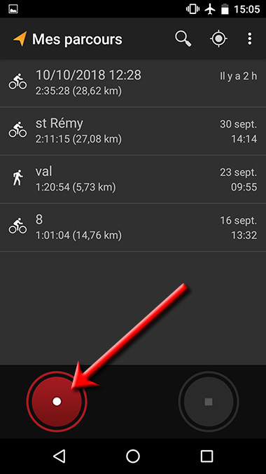
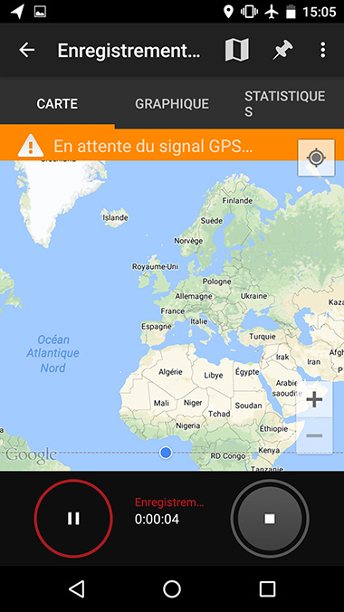
Commencer l'enregistrement
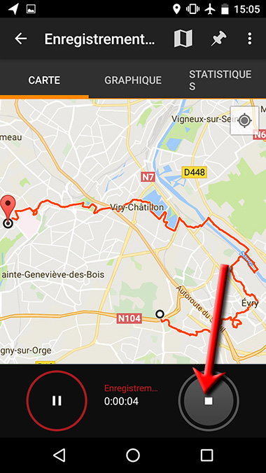  
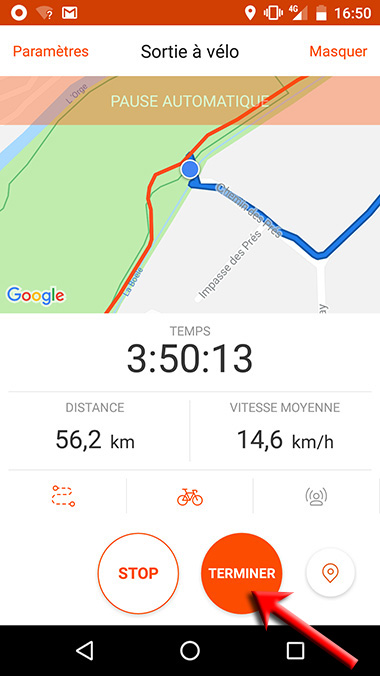
A la fin de la sortie, cliquer sur arrêt.
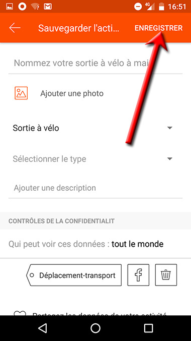
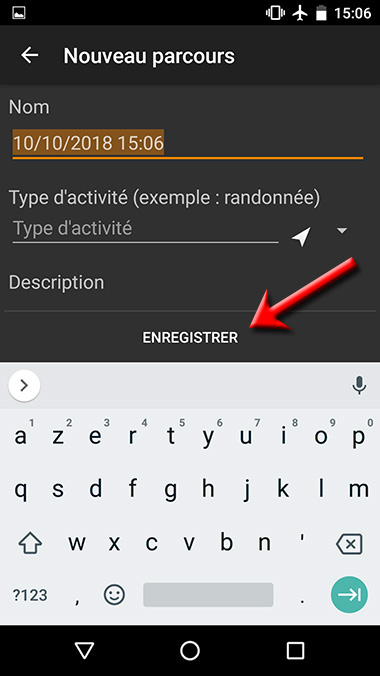
Nommer la sortie ou laisser la date.
Cliquer sur "ENREGISTRER"
Paramètres
Android
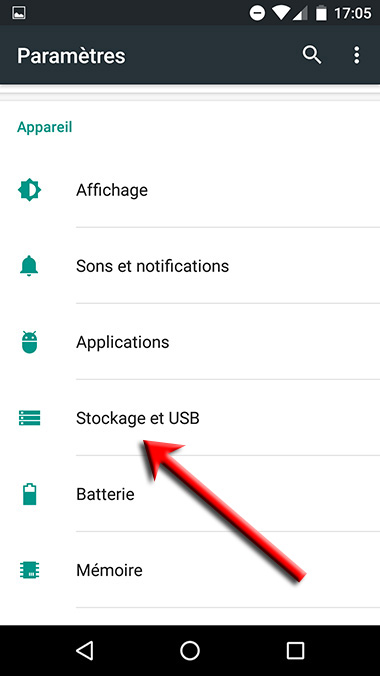 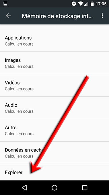
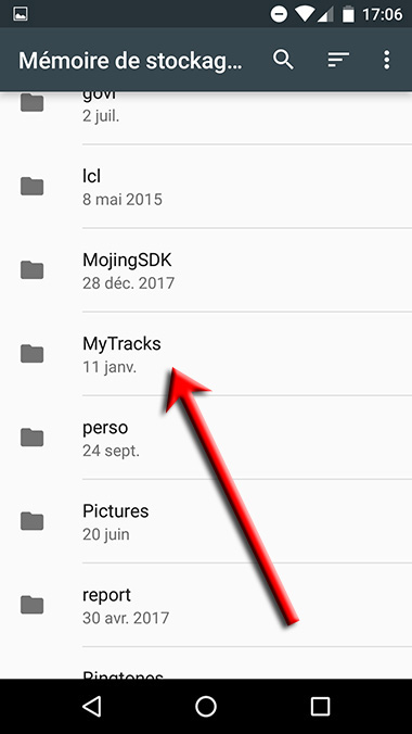  
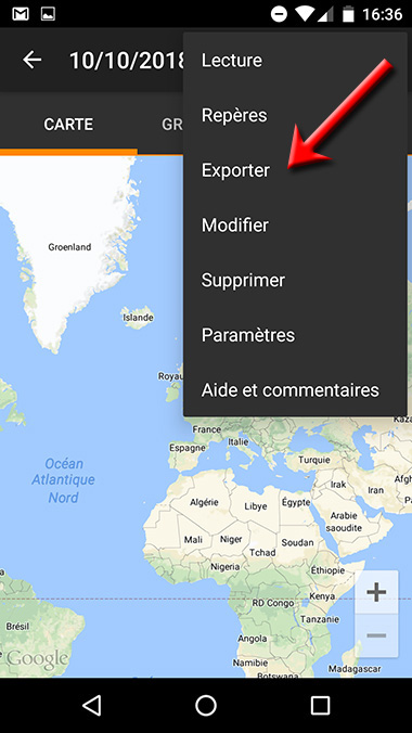
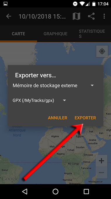
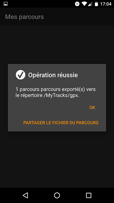
Exportation
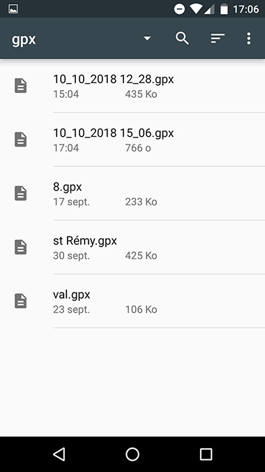
du fichier GPS au format gpx
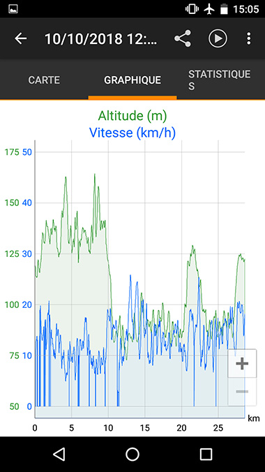
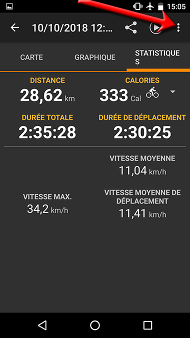
Remarque : l'appli mémorise des données numériques.
Ce sont les coordonnées GPS.
<?xml version="1.0" encoding="UTF-8"?>
<gpx
version="1.1"
creator="Créé par Mes parcours sur Android"
xmlns="http://www.topografix.com/GPX/1/1"
xmlns:topografix="http://www.topografix.com/GPX/Private/TopoGrafix/0/1"
xmlns:xsi="http://www.w3.org/2001/XMLSchema-instance"
xsi:schemaLocation="http://www.topografix.com/GPX/1/1
http://www.topografix.com/GPX/1/1/gpx.xsd http://www.topografix.com/GPX/Private/TopoGrafix/0/1
http://www.topografix.com/GPX/Private/TopoGrafix/0/1/topografix.xsd">
<metadata>
<name><![CDATA[st Rémy]]></name>
<desc><![CDATA[]]></desc>
</metadata>
<trk>
<name><![CDATA[st Rémy]]></name>
<desc><![CDATA[]]></desc>
<type><![CDATA[cyclisme]]></type>
<extensions><topografix:color>c0c0c0</topografix:color></extensions>
<trkseg>
<trkpt lat="48.70433" lon="2.07276">
<ele>113</ele>
<time>2018-09-30T12:14:53.782Z</time>
</trkpt>
<trkpt lat="48.704298" lon="2.072846">
<ele>116</ele>
<time>2018-09-30T12:15:10.407Z</time>
</trkpt>
<trkpt lat="48.704262" lon="2.072908">
<ele>114</ele>
<time>2018-09-30T12:15:02.000Z</time>
</trkpt>
<trkpt lat="48.704187" lon="2.072897">
<ele>115</ele>
|